Metrikler
Yayın
15
Açık Erişim
1
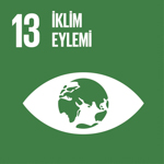
BM Sürdürülebilir Kalkınma Amaçları
Eğitim Bilgileri
2005 - 2010
2005 - 2010Doktora
University of Houston, Amerika Birleşik Devletleri
2001 - 2004
2001 - 2004Yüksek Lisans
Texas Tech University, Amerika Birleşik Devletleri
1993 - 1998
1993 - 1998Lisans
İstanbul Teknik Üniversitesi, Maden Fakültesi, Jeoloji Mühendisliği Bölümü, Türkiye
Yaptığı Tezler
2010
2010Doktora
Application of remote sensing techniques to understand the mechanisms behind the Caspian Sea lake-level fluctuations
University Of Houston
2004
2004Yüksek Lisans
Investigation of Texas High Plains Using Geophysical Methods
Texas Tech University
Akademik Ünvanlar / Görevler
2018 - Devam Ediyor
2018 - Devam EdiyorDr. Öğr. Üyesi
Kocaeli Üniversitesi, Mühendislik Fakültesi, Jeoloji Mühendisliği Bölümü
2013 - 2018
2013 - 2018Yrd. Doç. Dr.
Kocaeli Üniversitesi, Mühendislik Fakültesi, Jeoloji Mühendisliği Bölümü
Makaleler
Tümü (10)
SCI-E, SSCI, AHCI (9)
SCI-E, SSCI, AHCI, ESCI (10)
ESCI (1)
Scopus (9)
TRDizin (1)
2025
20251. Comparison of two meandering rivers using satellite remote sensing to unravel the effects of dams on river evolution, western Turkey
Yılmaz M., ÖZYAVAŞ A.
Hydrological Sciences Journal
, cilt.70, sa.14, ss.2513-2529, 2025 (SCI-Expanded, Scopus)


2022
20222. Automatic detection of geological lineaments in central Turkey based on test image analysis using satellite data
Tozun K. A., ÖZYAVAŞ A.
ADVANCES IN SPACE RESEARCH
, cilt.69, sa.9, ss.3283-3300, 2022 (SCI-Expanded)
2020
20203. Distribution of rocks in Pinarbasi Ophiolite from central Anatolia (Turkey) based on analysis of ASTER and Landsat-8 data
Cortuk R. M., Çelik Ö. F., Alkan A., Ozkan M., Özyavaş A.
GEOLOGICAL JOURNAL
, cilt.55, sa.10, ss.6810-6822, 2020 (SCI-Expanded, Scopus)
2020
20204. New logical operator algorithms for mapping of hydrothermally altered rocks using ASTER data: A case study from central Turkey
Tozun K. A., ÖZYAVAŞ A.
ORE GEOLOGY REVIEWS
, cilt.122, 2020 (SCI-Expanded)
2020
20205. Mapping of Volcanic Rocks Around Susuzdag and Tekkedag (Cappadocia-Turkey) Using ASTER image
ÖZYAVAŞ A.
TURKIYE JEOLOJI BULTENI-GEOLOGICAL BULLETIN OF TURKEY
, cilt.63, sa.2, ss.225-240, 2020 (ESCI)

2018
20186. Lithological discrimination of accretionary complex (Sivas, northern Turkey) using novel hybrid color composites and field data
Ozkan M., ÇELİK Ö. F., ÖZYAVAŞ A.
JOURNAL OF AFRICAN EARTH SCIENCES
, cilt.138, ss.75-85, 2018 (SCI-Expanded, Scopus)
2016
20167. Assessment of image processing techniques and ASTER SWIR data for the delineation of evaporates and carbonate outcrops along the Salt Lake Fault, Turkey
ÖZYAVAŞ A.
INTERNATIONAL JOURNAL OF REMOTE SENSING
, cilt.37, sa.4, ss.770-781, 2016 (SCI-Expanded)
2012
20128. The driving forces behind the Caspian Sea mean water level oscillations
Ozyavas A., Khan S. D.
ENVIRONMENTAL EARTH SCIENCES
, cilt.65, sa.6, ss.1821-1830, 2012 (SCI-Expanded)

2010
20109. A possible connection of Caspian Sea level fluctuations with meteorological factors and seismicity
Ozyavas A., Khan S. D., Casey J. F.
EARTH AND PLANETARY SCIENCE LETTERS
, cilt.299, sa.1-2, ss.150-158, 2010 (SCI-Expanded)
2008
200810. Assessment of Recent Short-Term Water-Level Fluctuations in Caspian Sea Using Topex/Poseidon
Ozyavas A., Khan S. D.
IEEE GEOSCIENCE AND REMOTE SENSING LETTERS
, cilt.5, sa.4, ss.720-724, 2008 (SCI-Expanded)
Hakemli Bilimsel Toplantılarda Yayımlanmış Bildiriler
2021
20211. Susuzdağ ve Tekkedağ (Kapadokya / Türkiye) Çevresindeki Volkanik Kayaçların ASTER Görüntüsü Kullanarak Haritalanması
Özyavaş A.
Türkiye Jeoloji Kurultayı, Ankara, Türkiye, 24 - 28 Mayıs 2021, ss.131-132, (Özet Bildiri)

2017
20172. HYBRID COLOR COMPOSITES AND SPECTRAL INDICES FOR LITHOLOGIC MAPPING OF THE ACCRETIONARY COMPLEX WITH ASTER DATA
OZKAN M., ÇELİK Ö. F., ÖZYAVAŞ A.
INTERNATIONAL SYMPOSIUM ON GIS APPLICATIONS IN GEOGRAPHY AND GEOSCIENCES, Çanakkale, Türkiye, 18 - 21 Ekim 2017, ss.88, (Özet Bildiri)
2016
20163. SİVAS IN KUZEYİNDEKİ OFİYOLİTİK KAYAÇLARINLANDSAT ASTER UYDU GÖRÜNTÜLERİYLE HARİTALANMASI
Özkan M., ÇELİK Ö. F., ÖZYAVAŞ A.
6. UZAKTAN ALGILAMA-CBS SEMPOZYUMU, Türkiye, 5 - 07 Ekim 2016
2016
20164. Niğde ve Kayseri bölgelerinde Yüzeylenmiş kayaçların alterasyon özelliklerinin ASTER uydu görüntüleri yardımıyla tesbit edilmesi
Tözün K. A., ÖZYAVAŞ A.
UZAKTAN ALGILAMA-CBS SEMPOZYUMU (UZAL-CBS 2016), Adana, Türkiye, 5 - 07 Ekim 2016, ss.569-578, (Tam Metin Bildiri)
2016
20165. Sivas ın kuzeyindekiofiyolitik kayaçların landsat ASTER uydu görüntüleriyle haritalanması
Özkan M., ÇELİK Ö. F., ÖZYAVAŞ A.
UZAKTAN ALGILAMA-CBS SEMPOZYUMU (UZAL-CBS 2016), Adana, Türkiye, 5 - 07 Ekim 2016, ss.685, (Özet Bildiri)
Desteklenen Projeler
2019 - 2020
2019 - 2020Geliştirilmiş Mantıksal Operatör Algoritmaları ve Aster Görüntüsü Kullanılarak Kayseri Çevresindeki Hidrotermal Alterasyonların Haritalanması ve Olası Metal Zenginleşmeleri
TÜBİTAK Projesi , 1002 - Hızlı Destek Programı
ÖZYAVAŞ A. (Yürütücü)
2016 - 2017
2016 - 2017UZAKTAN ALGILAMA VE GIS UYGULAMALARI İLE NİĞDE VE KAYSERİ ÇEVRESİNDEKİ METALİK CEVHERLEŞMENİN BELİRLENMESİ
Yükseköğretim Kurumları Destekli Proje , BAP Araştırma Projesi
ÖZYAVAŞ A. (Yürütücü), ALTINOK E., TÖZÜN K. A.
Atıflar
Toplam Atıf Sayısı (WOS): 87
h-indeksi (WOS): 5
Jüri Üyelikleri
Mayıs-2022
Mayıs 2022Tez Savunma (Yüksek Lisans)
Taşköprü (Kastamonu) Eosen İstifinin Jeolojik Özellikleri ve Kömür Potansiyeli - Kocaeli Üniversitesi
Ocak-2021
Ocak 2021